

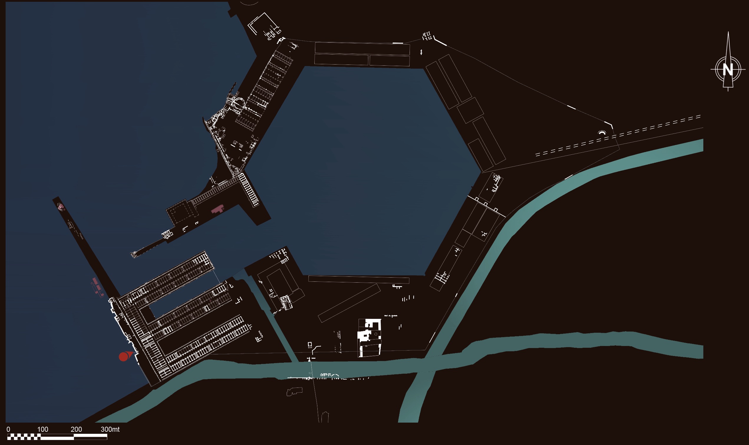
Portus was the Roman Empire’s main seaport, essential for the supply of goods from the entire Mediterranean. At its maximum extent, the complex covered an area of about 350 hectares. The first harbour installation, construction for which was begun by Emperor Claudius in 42 AD, was inaugurated during Nero’s reign in 64 AD and covered an area of about 200 hectares. Of this harbour, some sections of piers, the vast storage complex of Trajan’s warehouses, the Portico of Claudius, and a wet dock are still visible today. An artificial channel, Fossa Traiana, or “Trajan’s Canal” (today’s Fiumicino canal), connected the Harbour of Claudius with the Tiber, thus allowing the river/maritime vessels (naves caudicariae) to travel up towards Rome with cargo transferred from seafaring cargo ships (naves onerariae). Acknowledging the critical issues raised by silting-up and storm surges in the basin of Claudius, Emperor Trajan, between 110 and 117 AD, built a second, internal basin, dug into the dry land. Perfectly hexagonal in shape, it covered about 32 hectares and was endowed with new warehouses, a series of new buildings including a temple dedicated to Liber Pater, the Imperial Palace complex (also performing administrative functions) and shipyards. The connection between this new basin and Rome was provided through the construction of another channel, the Roman Canal (no traces of which exist today) and the extension of Via Campana-Portuensis. The link to Ostia was provided via another canal that ran parallel to Via Flavia, the “Ostia-Portus” canal.
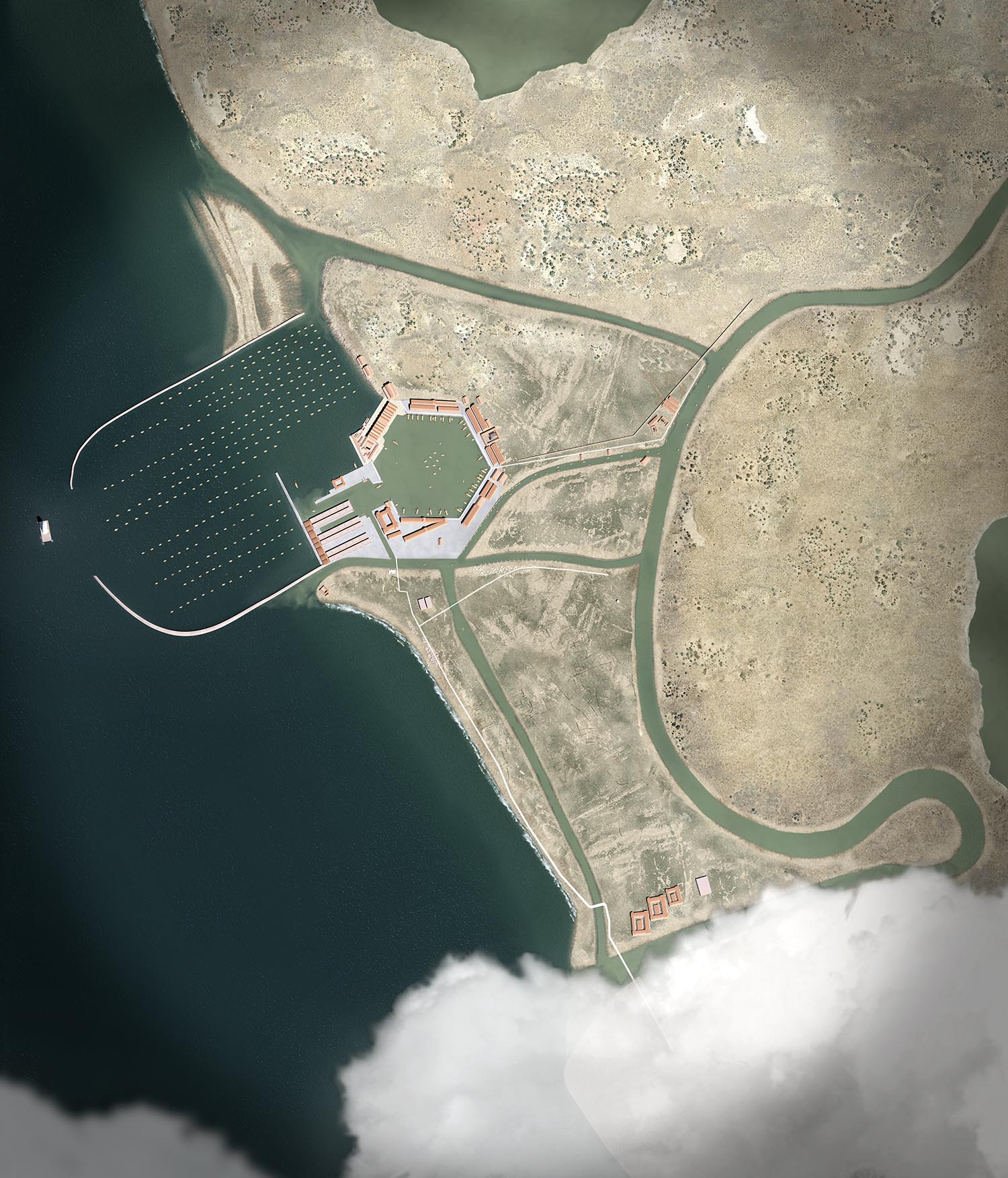
Reconstructed aerial view of the Harbour of Claudius
(Portus Project/Artas Media)
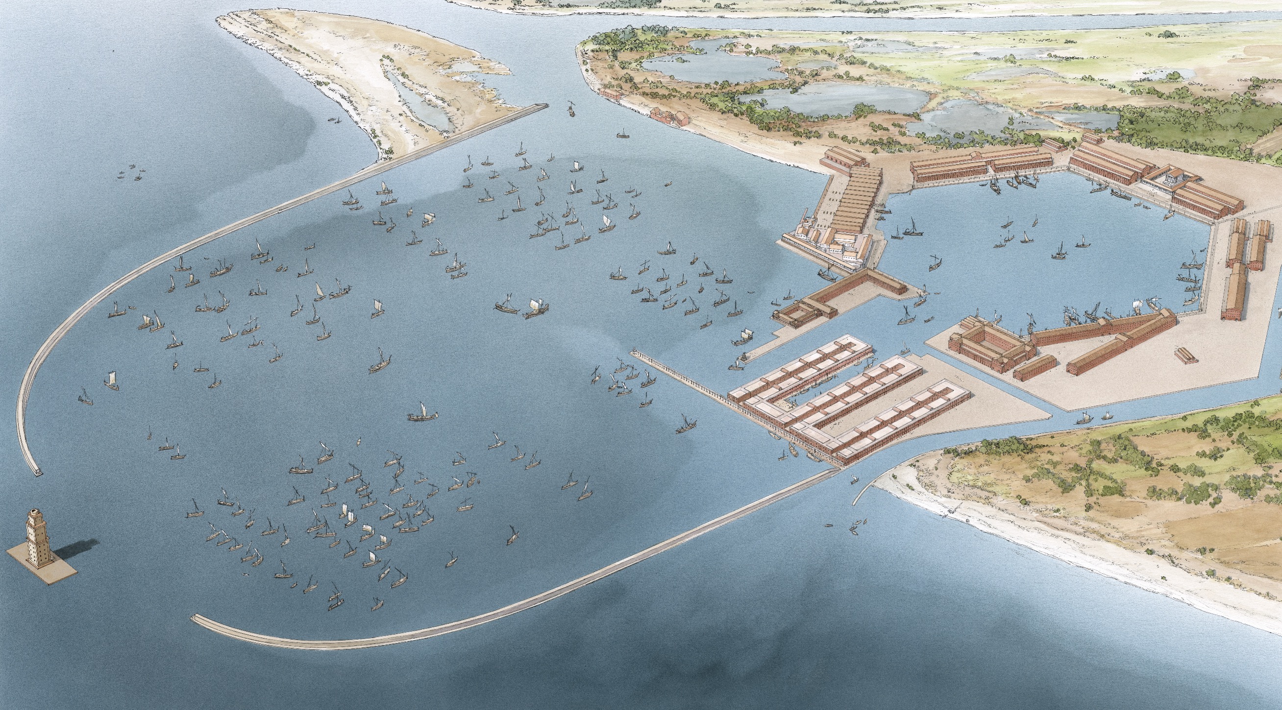
Reconstructed aerial view of the Harbours of Claudius and Trajan in the 2nd century AD
(J.-C. Golvin)
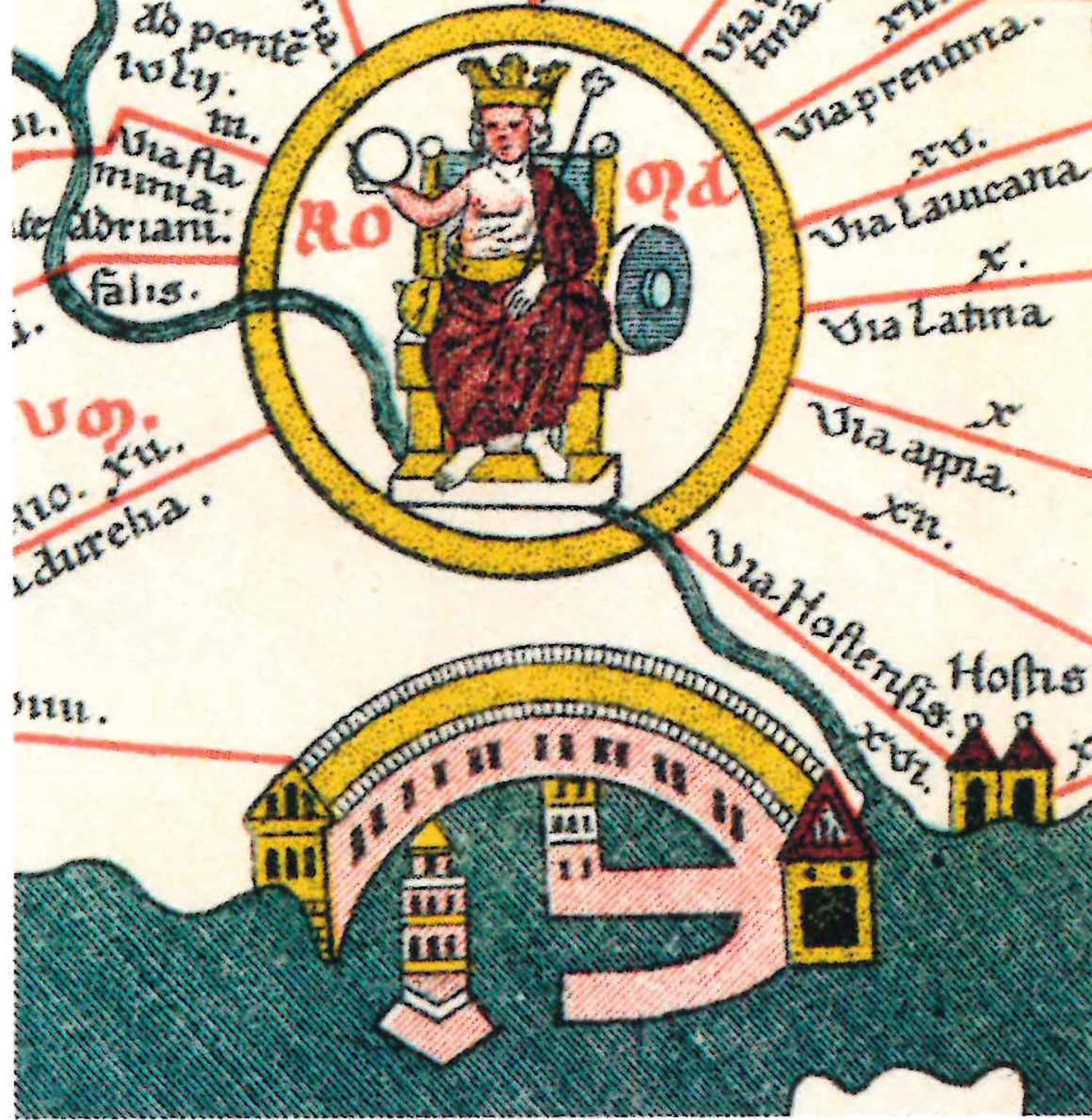
The Portus depicted on the Tabula Peutingeriana, a Medieval copy of a Roman-era map dating to the second half of the 4th century AD.
(facsimile by K. Miller, 1887)
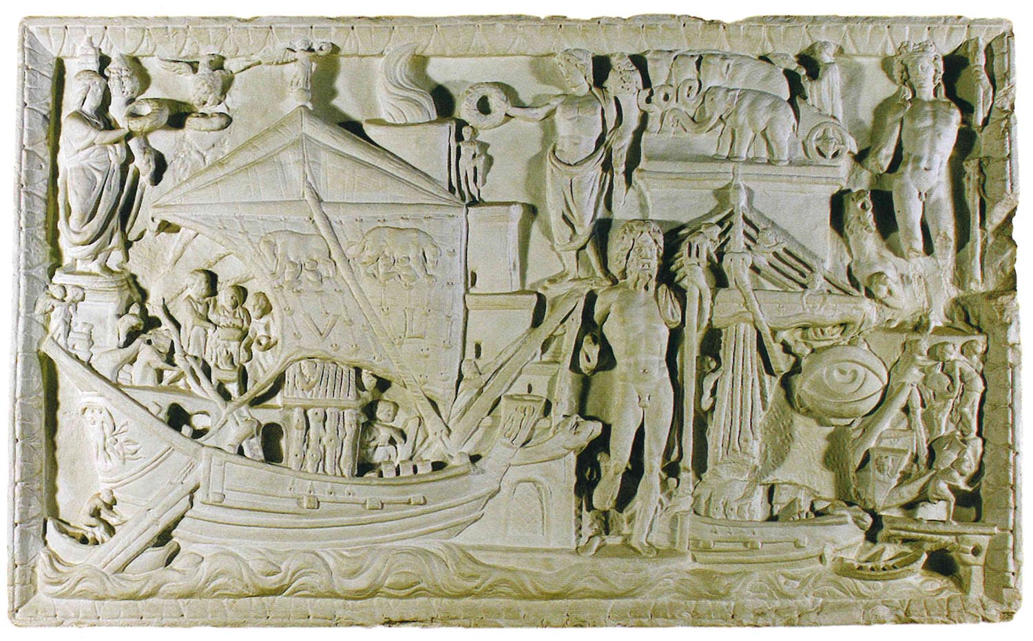
Cast of the Torlonia relief depicting a detailed and symbolic view of Portus
(Museo delle Navi di Fiumicino)
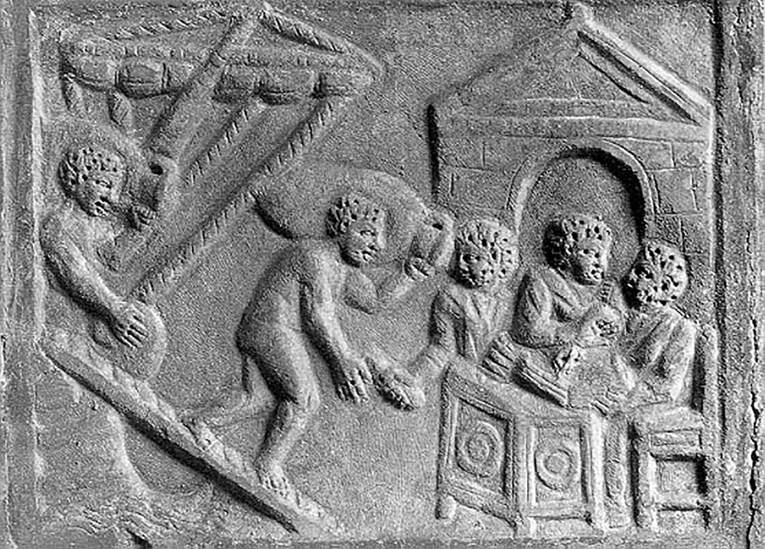
Relief of the Tabularii of the Harbour of Trajan
(Torlonia collection)